- School District 5 - Our Canada Series
School District 5 - Our Canada Series
Our Canada - An Introduction
Width Height
Subject(s): Canadian Social Studies, First Nations Studies, Social Studies
Grade Level: 3 - 5, 6 - 8, 9 - 12
This introductory program in the Our Canada Series provides students with a broad overview of Canada - our geography, population, settlement pattern, industry, resources, vegetation and climate. Bright and clearly labelled maps introduce students to each province and each geographic region.
Includes PDF Resource Guide.
|
Running Time: 18:52 Country of Origin: Canada Captions: |
Producer: McIntyre Media Inc. Copyright Date: 2016 Language: English |
Video Chapters
-
Our Canada 01:35
Canada is a great, expansive country, with many varying climate... -
Political Regions of Canada 01:05
When you take a look at a map of Canada, one can see the way it... -
Landforms and Geographic Regions 05:09
The many different landscapes of Canada have been captured by... -
Vegetation Zones 01:38
There are many types of vegetation zones in Canada. Forests... -
Climate Regions 01:35
Being the second-largest country in the world, Canada has all... -
Natural Resources 02:35
Natural resources are things that are found in nature that can... -
Environmental Stewardship; Indigenous Worldview 01:14
Canada is a vast and beautiful country with many ecosystems that...
TRANSCRIPT
Close- This is our Canada, a land of immense distances and many different land forms. We're fortunate to have more fresh water than any other country on Earth. We have many kinds of vegetation, and the climate is very different from one part of the country to the next. Canada's people live in many different kinds of geographic environments.
- Did you know Canada is the second largest country in the world, covering over 9.9 million square kilometers? That's huge. To get from Cape Spear, Newfoundland, at the eastern edge of Canada to the western edge in Tofino, British Columbia, you would have to travel over 7,000 kilometers of road. That would be a lot of driving. Or if you wanted to travel from Pelee Island at the southern tip of Ontario to Cape Columbia at the northern tip of the Arctic, there'd be no roads on some parts of that trip.
- Canada has six different time zones, from Newfoundland and Labrador in the east to the Pacific time zone in the west. When it is 7:30 a.m. in St. John's, Newfoundland, It is only 3 a.m. In Victoria, British Columbia. We share a border with the United States, both to the south and next to Alaska in the northwest. If you look at a map with the North Pole in the center, you'll see our other neighbors across the Arctic Ocean-- Russia, Norway, and Greenland.
- Political regions of Canada-- a political map of Canada shows how our country has been organized into what is known as political regions. We have 10 provinces and three territories. Each one has its own capital city. Ottawa is our country's capital, and it is home to the Parliament buildings and Canada's federal government. Representatives from each province are elected to sit in the House of Commons to make decisions for our country.
- c these provinces and territories are grouped into geographic regions. Newfoundland and Labrador, Prince Edward Island, Nova Scotia, and New Brunswick are in the Atlantic region. Central Canada includes Ontario and Quebec. Manitoba, Saskatchewan, and Alberta are known as the Prairie Provinces. The west coast region is British Columbia, and the northern region includes Canada's three territories, Nunavut, Northwest Territories, and the Yukon Territory.
- Bodies of water-- Canada has the longest coastline in the world. Both the east coast and the west coast have deep fjords.
- Fjord-- a narrow, deep inlet of the sea between cliffs.
- The Pacific coast has large offshore islands and straits. In the Arctic coastal waters, sea ice makes navigation difficult for ships. But when it is frozen, people can travel by dog sled or snowmobile.
- However, due to the changing climate, global warming, these ice roads that are used in the winter for transportation are beginning to melt or are freezing later in the winter. Climate graphs show average precipitation and temperatures typically experienced in a particular location. With global warming, the Northwest Passage, a sea route above the Canadian Arctic linking the Pacific and the Atlantic oceans, is also opening up, making it possible for ships to cross the Arctic Ocean, at least for part of the year. This route will be much shorter than the route ships have had to use in the past.
- While some people might be happy about this, other people are concerned. What would happen if a ship ran into trouble in these remote and icy waters? Our numerous lakes, rivers, and ponds play an important role in the country's ecosystem.
- Ecosystem-- a community of plants and animals. They are a home for many types of marine life. Almost 200 kinds of fish live in our freshwater environments. We have many kinds of amphibians, frogs, turtles, newts, and salamanders, and many birds get their food from living things found in the water.
- Rivers and lakes were the major transportation routes in the early years of our country, and many of our cities were built on a major body of water. The St. Lawrence River and the Great Lakes water system are still important today as major shipping routes, as well as for recreation. The Welland Canal, the locks at Sault St. Marie and the St. Lawrence Seaway locks make it possible for ships to travel from the Atlantic Ocean all the way up to Thunder Bay on Lake Superior. That's a distance of 3,700 kilometers.
- Landforms-- Canada has many different types of landscapes, and artists have been inspired by them. The group of seven artists and Tom Thomson became famous for their paintings, which often show Canada's rugged wilderness landscapes. Emily Carr in British Columbia is known for her western forest scenes. Today artists are still inspired by Canada's beautiful landscapes. Our varied landscapes are created by different kinds of land forms. Mountains, shorelines, prairies, forests, beaches, rolling hills, and sand dunes-- Canada has them all.
- Geographers have divided Canada into six physical geographic regions. Each region has similar landforms, climate, vegetation, and soil throughout. Each region is a unique reflection of the geological processes which created them.
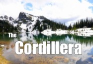
- The Cordillera Region-- Cordillera, a system of mountain ranges. In Western Canada, the Cordillera region has high mountain ranges such as the Rocky Mountains and the Coast Mountains. It also has plateaus, valleys, foothills, and plains.
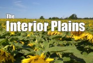
- The Interior Plains-- The Interior Plains region of Canada lies between the western mountains and the Canadian Shield.
- Plains-- a large area of flatlands with few trees. It has grasslands in the south and various types of forests further north and east. Farmers grow grain in Manitoba and Saskatchewan, and ranchers in Alberta raise cattle on the plains. Many of Canada's oil and gas resources are also found here as a result of the geologic processes in the Earth's crust over millions of years.
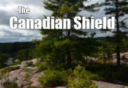
- The Canadian Shield-- the Canadian Shield contains some of the oldest rocks on Earth. The advance and retreat of glaciers left countless lakes, rivers, streams, and ponds. Before Europeans arrived, the Shield region was home to the First Nations nomadic hunters, who traveled the waterways and the forest trails. The Shield is a rich source of natural resources, including minerals, hydroelectric power, and forest resources today.
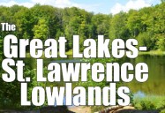
- The Great Lakes/ St. Lawrence Lowlands-- The Great Lakes/ St. Lawrence Lowlands stretch from Lake Huron to Quebec City. This area has rich soil, and much of Canada's population lives here, an economic and industrial heartland of the country. Most parts of this region were once covered with deciduous forests-- deciduous, trees that drop their leaves and fall-- or a mixture of deciduous and coniferous forests.
- Conifer-- a tree that usually has green leaves all year. Many kinds of animals and birds are found here. This area was once the home of the of [? the Hada ?] Nashoni Nations and the Wendat Nations.
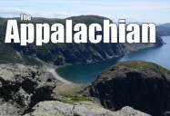
- The Appalachian region-- east of this area is the Appalachian region. These mountains are much older than those in the Western cordillera and not nearly as high. Erosion processes have worn down these once-majestic old mountains. In between the mountains there are plains, lowlands, and valleys with fertile soil. The mixed coniferous and deciduous forests are home to caribou, moose, and black bears. Some of the best fishing in the world can be found in this region.
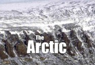
- The Arctic-- and finally we have the Arctic region. It includes the in Innuitan Mountains in the far north. Most of the land here is permanently frozen, with little vegetation. Today, rising global temperatures are leading to some melting of the permafrost. This has an impact on structures such as buildings and pipelines as the ground shifts. This has been home to the Inuit people and the early Aboriginal peoples for thousands of years. The Arctic region also includes the Arctic lowlands, which include barren islands. The Hudson Bay lowlands are mostly peat bog plains. Many tourists come north to see polar bears or to watch the awesome northern lights.
- Vegetation zones-- there are many different types of vegetation that grow across Canada. Forests can vary a great deal. In the Arctic regions, only a few short spruce trees or aspens grow. Low shrubs can be seen in damp areas. The boreal forest, or taiga, covers over half of Canada's landmass.
- Taiga-- coniferous forest in high northern areas. Coniferous trees, like spruce and pine, and deciduous trees, like birch and larch, can be found from the Yukon to Newfoundland. On the Pacific coast, forests also cover large areas, and there are some old-growth forests that people are fighting to protect.
- In the southeastern part of Canada there are deciduous woodlands, although much of this has been cleared for agriculture and settlements today. Prairie grasses grow in the southern plains area, and much of this land is also now used for agriculture. Wildflowers cover the floor of the eastern woodlands in the spring before the trees have grown their leaves.
- The Arctic tundra has a great variety of mosses, lichens, and short-lived summer-flowering plants. Berry bushes at one time provided food for Aboriginal peoples across Canada. You can still find wild blueberries growing in rocky areas. Cranberries thrive in the wetlands. Buffalo berries grow on the prairies, and salmon berries are found along the Pacific coast. Raspberries and blackberries provide food for wildlife across the country.
- Climate regions-- in addition to our variety of physical landscapes, Canada also has a variety of climate regions. Climate is what a region's weather is like over a long period of time.
- Climate is determined by a number of factors. One factor is latitude, which is the location of an area between the North Pole and the Ecuator. Another factor is the elevation, or the height of a point of land in relation to sea level. Our highest mountain is almost 6,000 meters above sea level. Also, large bodies of water affect climate, so if you live close to an ocean or a large lake, it might be warmer and wetter than it is further inland.
- Winds and the shape of the landscape also affect climate. Near the Canada- United States southern border, there are warm summer months and cold winters. The west coast has milder winters and rainfall throughout the year. The driest area is the central prairie, and in the highest mountains, sometimes the snow never completely melts. Hot, cold, dry, humid, wet? You find it all in Canada.
- Canada has over 36 million people, but most of us live within 150 kilometers of the southern border between Canada and the United States. The climate is not as cold most of the year as it is further north. Do you think this is why people choose to live here?
- Natural resources-- Canada has a great variety of natural resources, and our economy is largely dependent on them. Natural resources are things that are found in nature and can be used by humans. Our great forests are a source of wood for industry. Our fresh water is important for transportation, for recreation, for hydroelectric power, and for manufacturing. We all use water every day. Your water may come from a nearby lake or river.
- Canada also has a lot of other natural resources-- oil, coal, natural gas, and the wind are all natural resources that can provide power and heat for your home. Do you know where your electric power comes from?
- Minerals are another very important natural resource, and there are mines in many areas of Canada. Did you know that diamonds are mined in Canada? Many metals are found Canada, and we use these every day. Iron ore and nickel are used to make steel, so pots and pans, your bike, and your family car could only be made because someone worked in a mine.
- We are the world's second-largest miner of uranium. It is used as a fuel in nuclear reactors and nuclear power stations. Gold and copper are also important metals in Canada. They are used for jewelry, for electronics, by dentists, and at the Royal Canadian Mint to make our coins. We mine nonmetal minerals like potash, which provides fertilizer for farms. In fact, Canada is one of the world's largest producers of potash, with much of it coming from Saskatchewan.
- And have you ever wondered where salt comes from? It might have come from the world's largest salt mine, in Goderich, Ontario. Here salt is mined for things like food, and also to keep highways free of ice in the winter.
- Canada's resources also include other things, like fish and seafood. Tonight, take a look at the label on a tin of salmon or tuna in your cupboard. Where did it come from? Your next fresh salmon dinner may have come from either the east coast or the west coast of Canada. And have you ever eaten Arctic char? Guess where that comes from? You're right. This fish is found in the Arctic Ocean.
- Environmental stewardship-- Canada is a large country with an array of physical landscapes and climate regions. Our 36 million people also have an impact on our unique geography, both positively and negatively. In order to protect this beautiful country, we need to take steps to ensure that our resources and ecosystems are protected. Many of our ecosystems are being preserved for the future through national parks, provincial parks, and conservation areas. People and governments are more aware of the importance of sustainable forestry practices, responsible mining, and green energy production.
- We can learn a lot from Aboriginal peoples, who respect and honor the land. They see themselves as part of the ecosystem. They are keepers and protectors of the land, and they were Canada's first environmentalists. We need to continue to respect and take care of this land of ours.
- So that's a quick tour of the amazing land we all call home. Together we can help Canada continue to be one of the greatest countries in the world.
TRANSCRIPTS:
Interactive Transcript
Transcript (PDF)
