- School District 5 - Our Canada Series
School District 5 - Our Canada Series
Our Canada - The Cordillera
Width Height
Subject(s): Canadian Social Studies, First Nations Studies, Science, Social Studies
Grade Level: 3 - 5, 6 - 8, 9 - 12
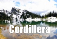
The Cordillera is the most western geographic region in Canada. Formed over millions of years as a result of plate tectonics, this is a beautiful area with a varied landscape of high peaks, glaciers, rivers and fertile desert-like valleys. The ocean and mountains combine to influence both climate and vegetation. The west coast features ancient cedars, beautiful totem poles carved by First Nation groups and a spectacular coastline where some of the world's largest aquaculture farms can be found.
Includes PDF Resource Guide.
|
Running Time: 14:55 Country of Origin: Canada Captions: |
Producer: McIntyre Media Inc. Copyright Date: 2016 Language: English |
Video Chapters
-
The Cordillera 02:27
The Cordillera is the most western geographic region in Canada... -
Rock in the Cordillera 01:31
In the Cordillera region, scientists have discovered some... -
Volcanoes Shaping the Cordillera 01:02
Volcanoes have been shaping the mountains in the Cordillera... -
Ecozones in the Codillera 02:23
There are two main ecozones in the Cordillera region; the Taiga... -
Climate in the Cordillera 01:49
The climate in the Cordillera varies from some of the hottest to... -
Indigenous Peoples in the Cordillera 01:22
There are many First Nations people who call the Cordillera... -
Ecotourism and Resources in the Cordillera 03:36
Tourism is a very important in the Cordillera region from ski...
TRANSCRIPT
Close- If you were to plan a trip to another part of Canada you would probably look for a map of that area. Maps can show roads and cities, but they can also show us land forms.
- Canada's six geographic regions are very different from one another. Each has different landforms. Different kinds of vegetation grow in each region. And weather is always varied across the country. The first time you see the mountains in the Cordillera Region, you are sure to be impressed.
- The Cordillera is the most Western geographic region in Canada. It includes British Columbia, the Yukon, southwest Alberta, and part of the Northwest Territories.
- A Cordillera is a mountain range. It is a series of connected mountains usually formed at the same time in Earth's history. Some of the most spectacular scenery in the world can be found here. The Cordillera Region has a number of mountain systems. The Rocky Mountains, and the Columbia Mountains run from southern Alberta to the Yukon. The coast mountains further West are in British Columbia along the Pacific Ocean. If you climb to the top of Mount Logan, Canada's tallest mountain, you would be almost 6,000 meters above sea level.
- How did these mountains form? Scientists are still learning about the history of the earth, but we know that the Rocky Mountains were formed millions of years ago. Most geologists think that two giant slabs of rock layers of the Earth's crust slowly move towards each other. These plates gradually pushed the rock upwards. This theory of mountain formation is the result of plate tectonics. You can often see layers of rock in mountains lying at an angle to the surface of the earth.
- One of the clues to the age of a mountain is the fossils that are found in the rock. Scientists found some amazing fossils recently while digging in the Burgess Shale in the Rocky Mountains. Shale is one kind of sedimentary rock. It was formed when mud settled to the bottom of ancient bodies of water and was compacted over millions of years. The pressure gradually turned it into rock.
- If you mix some garden soil into a glass of water the soil will soon settle at the bottom of the class. That's sediment. Any living thing trapped in that sediment was preserved as a fossil when the mud hardened. Many other kinds of rock are found in the Cordillera Mountain ranges. The Coast Mountain Range has a lot of granite rock. This is a very hard, colorful rock often used for kitchen counters and grave stones. Granite is an igneous rock that was formed when hot magma below the earth's surface began to cool. Magma is hot liquid rock. You can see magma when lava spills out of the top of a volcano and flows down the sides.
- West of the Rocky Mountains is the interior plateau. This high plain region is divided by deep river valleys. Here the Fraser River has cut into the rock forming a canyon. It is the longest river in British Columbia. Further west, the coast mountains are in a very active, seismic area. Earthquakes are more common here than in the rest of Canada. The largest earthquake ever recorded in Canada happened off the coast of Haida Gwaii, one of the many islands in the Pacific Coast Mountain range. Canada's only recorded volcano erupted at lava forks in northern British Columbia. Volcanoes helped to form some of the coast mountains and eruptions are described in Aboriginal legends. The Squamish people name the black tusk on Lake Garibaldi the landing place of the Thunderbird. Their legend describes how thunderbirds' lightning blackened these rocks.
- Here in the Cordillera Region there are many different ecozones. An ecozone is a large area with similar landforms, climate, vegetation, and animals.
- The Taiga Cordillera ecozone is at the north end of the Rocky Mountains range. Here there are high waterfalls, deep canyons, valleys, wild rivers, and steep mountains. Spruce and birch trees grow at the southern end of this ecozone while low shrubs, mosses, and lichens cover the tundra further north. Not many people live here, but there are plenty of caribou, black bears, and wolves. Millions of birds come north to nest here in the springtime. Most of the ground here is permanently frozen. Permafrost is soil that is frozen for more than two years in a row. The Dempster highway in the Yukon was built on top of a high gravel bed so that the permafrost would not melt and sink the road.
- In southern Yukon and northern British Columbia is the Boreal Cordillera ecozone. Mountains and plateaus are separated by valleys and lowlands. When gold was found in the Yukon River in 1896 thousands of prospectors rushed to the Klondike hoping to get rich. Trees grow in the lower part of these mountains, but higher up you see only mosses and lichen with bare rock and snow at the peak. Owls and hawks soar in the skies. Otters swim in the rivers and red foxes hunt through the woods. Billions of black flies and mosquitoes can make life unpleasant here in the summer.
- In southern British Columbia and southwestern Alberta you are in the Montane Cordillera ecozone. Just below the peaks of the Rocky Mountains and the coast mountains, you see short alpine plants and mosses growing. Further down the ground is covered with conifer forests. In the valleys between the two mountain ranges grasses grow in the silt, and clay soil. The climate in the cordillera ranges from some of the hottest to some of the coldest in Canada. On the coast the ocean brings moist air to the land keeping the temperature moderate. Southern British Columbia is much warmer than the rest of Canada and usually has rain year round.
- Rain forests with huge, ancient trees are found here, and this unique biosphere is protected by the Pacific Rim National Park Reserve. The warm air from the Pacific travels eastward until it is forced upward by the coast mountains. It cools as it travels over the mountains and its moisture falls as rain or snow. By the time the air gets to the interior valleys it is dry. The climate here is hot in summer and cold with some snow in winter. Desert plants such as sage bush and cactus grow in some of these valleys.
- The northern section of the cordillera is the driest part of the region. The winter is long and cold and the summer is short. Only the top layer of soil thaws during the summer. So what will the roots of a plant do when they get to the permafrost? You guessed it. They will stop growing. Only special vegetation can survive here in the northern tundra. Tundra refers to a cold, treeless landscape. Lichen and mosses grown on rocks, and only plants with short roots can grow in the thin layer of thawed soil.
- Elevation effects climate, too. If you hike up a mountain you could start out in a t-shirt and need a winter coat by the time you get to the top.
- There are many different first nations people living in the cordillera. For many thousands of years, the Haida have lived off the west coast of British Columbia on the Haida Gwaii islands. They belong to either the eagle or the Raven clans and display the crests of their family on their canoes and on carved totem poles. The carved figures often recall stories from the past. The Haida were excellent hunters and gatherers, getting all they needed from their warm coastal environment. Today ecotourism and fishing are important in their economy.
- Many other First Nations people lived in the cordillera. In the Prince Rupert area the Tsimshian people traded things like furs, jade, and shells with other First Nations groups long before the Europeans arrived here. The Salish tribes hunted and fished along the Fraser and Columbia Rivers. The coast sailors Salish in Georgia Strait and Puget Sound. Their potlatch feasts were big celebrations of important events and each person invited was given a gift. Coast Salish carvers respected their ancestors through carved facemasks and totem poles. Today their art is admired by many people.
- In the cordillera today most people live in the southern half in narrow strips that follow mountain valleys and Coastal Plains. Greater Vancouver is Canada's third largest city. Victoria, the capital of British Columbia, is on the south end of Vancouver Island. Inland the sunny, dry climate of the Okanagan Valley is perfect for orchards, vineyards, and recreation. Tourism is important in the economy of the cordillera. Ski resorts and national parks like Banff and Jasper attract visitors from all over the world.
- Eco-tourism refers to travel that respects and appreciates natural environments. If you go on an Eco-adventure tour you might be sea kayaking with whales, you might watch bears fish for salmon, or you could raft along the rushing Fraser River.
- The west coast is famous for seafood. When you buy fresh salmon the label may read wild caught Pacific salmon. This salmon was caught by fishermen in the ocean or rivers. Much of our fish and seafood now comes from aquatic farms. The fish live inside a nest fence in a river or a bay and are fed by hand. You don't usually think of water environments when you think of farming. Aqua culture provides almost half of the fish eaten in the world today and some people are concerned about the health of farmed fish.
- Forestry is one of the main economic activities in the cordillera region. The abundance of trees has led to a strong lumber industry, which provides work for many people. It is also a controversial industry. Destructive forest practices cause people to be concerned about the destruction of this important ecosystem. Vancouver Island has lost almost 3/4 of its old growth forest to logging. Responsible forestry practices can help us to protect this important, renewable resource. A renewable resource is a natural resource that can be replaced when we use it. The government encourages companies to replant trees, protection important water sheds, and wildlife habitat.
- Mining is important the cordillera and the rocks provide us with copper, iron, silver, zinc, and gold. Coal is one of the major minerals found in this region and has been mined since the late 1800s. Millions of years ago, before the dinosaurs roamed the Earth, giant ferns grew in swamps. When they died they sank to the bottom of the swamps. Over time they were packed down by mud and more plants, and eventually they were compressed into a black rock like mineral we know as coal. This is called a nonrenewable resource because we can't make more in our lifetime.
- So that is a quick look at the geographic region we call the Cordillera. It is a region of Canada that many people love to visit. It is a land of 1,000 year old trees, glacier fed streams, and rugged mountain peaks. It is a landscape that has been home to humans for 10,000 years. Sustainable practices and industry, development, and truism will help to protect this wonderful region of Canada.
- [SOFT MUSIC PLAYING]
TRANSCRIPTS:
Interactive Transcript
Transcript (PDF)
